In Pre-Colonial Times Did We Call Ourselves African
From Tariq Berry author of The Unknown Arabs……

People had no trouble identifying themselves precolonial times and they didn’t identify themselves as “Africans”.
The concept of dividing the Earth into something called continents has no meaning whatsoever. Calling oneself by one of the names of the so-called continents that certain people have come up with has even less meaning. Those dividing the Earth and giving names to different areas of the Earth don’t even know what they base their divisions on. They can’t even seem to decide how many continents there are. Are there two continents, three, four, five, six, or seven continents?
Is it Europe and Asia or Eurasia:
Eurasia
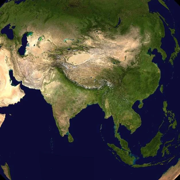
Is it Africa, Asia and Europe or is it Afro-Eurasia:
Afro-Eurasia
:max_bytes(150000):strip_icc()/Eurasia_location_map_-_Physical-5c21c2ba46e0fb0001c9c702.jpg)
And what is a continent exactly and what’s the purpose of this division of the Earth?
The Greeks were the first to come up with the idea of dividing the world into parts and calling each part a continent. At first they said that there were two continents. Then Libya was added as a third continent.
To the Ancient Greeks, Libya was one of the three known continents along with Asia and Europe. In this sense, Libya was the whole known African continent to the west of the Nile Valley and extended south of Egypt. Herodotus described the inhabitants of Libya as two peoples: The Libyans in northern Africa and the Ethiopians in the south. According to Herodotus, Libya began where ancient Egypt ended, and extended to Cape Spartel, south of Tangier on the Atlantic coast.

So those calling themselves Africans today would have called themselves Libyans in the past. Who knows what they will call themselves in the future. Perhaps the colonizers will one day change the name of the area and hence change the name of the people. After all, what is called Africa today isn’t what was called Africa in the past. What is called Asia today isn’t what was called Asia in the past. Do you know that in the past, all of the area until the western border of Egypt was called Asia.
The boundary between Asia and Africa was generally taken to be the Nile River. Herodotus[38] in the 5th century BC, however, objected to the unity of Egypt being split into Asia and Africa (“Libya”) and took the boundary to lie along the western border of Egypt, regarding Egypt as part of Asia. He also questioned the division into three of what is really a single landmass,[39] a debate that continues nearly two and a half millennia later…Through the Roman period and the Middle Ages, a few writers took the Isthmus of Suez as the boundary between Asia and Africa, but most writers continued to take it to be the Nile or the western border of Egypt (Gibbon). In the Middle Ages the world was usually portrayed on T and O maps, with the T representing the waters dividing the three continents. By the middle of the 18th century, “the fashion of dividing Asia and Africa at the Nile, or at the Great Catabathmus [the boundary between Egypt and Libya] farther west, had even then scarcely passed away”

The Nile
Martin W. Lewis and Karen E. Wigen say in their article The Myth of Continents:

For almost two millennia after Herodotus, the threefold division of the earth continued to guide the European scholarly imagination. The continental scheme was reinforced in late antiquity when early Christian writers mapped onto it the story of Noah’s successors. According to St. Jerome (who died circa A.D. 420), translator of the Vulgate Bible, “Noah gave each of his three sons, Shem, Ham, and Japheth, one of the three parts of the world for their inheritance, and these were Asia, Africa, and Europe, respectively.” This new theological conception had the merit of explaining the larger size of the Asian landmass by reference to Shem’s primogeniture. It also infused the Greeks’ tripartite division of the world with religious significance. This sacralized continental model would persist with little alteration until the early modern period.
Medieval Europe thus inherited the geographical ideas of the classical world, but in a calcified and increasingly mythologized form. Whereas the best Greek geographers had recognized the conventional nature of the continents—and insisted that the Red Sea made a more appropriate boundary between Asia and Africa than the Nile River—such niceties were often lost on their counterparts in late antiquity and the early Middle Ages. Martianus Capella, whose compilation of knowledge became a standard medieval text, took it as gospel that the world was divided into Europe, Asia, and Africa, with the Nile separating the latter two landmasses. Other influential encyclopedists of the period, including Orosius and Isidore of Seville, held similar views.
During the Carolingian period, by contrast, the inherited framework of Greek geography began to recede from view. The term Europe (in one form or another) was sometimes used to refer to the emerging civilization in the largely Frankish lands of Latin Christendom, which were occasionally contrasted with an increasingly fabulous Asia to the east. In fact, proponents of both Carolingian and Ottonian (German) imperialism, as well as the papacy, employed the concept of Europe as “a topos of panegyric, [and] a cultural emblem.” But until the late Middle Ages, reference to the larger formal continental scheme was largely limited to recondite geographical studies, finding little place in general scholarly discourse. Africa in particular did not figure prominently in the travel lore and fables of medieval Europeans. The southern continent at the time was dismissed as inferior, on the mistaken grounds that it was small in extent and dominated by deserts.
Scholarly geographical studies, of course, were another matter. Here the tripartite worldview of the Greeks was retained, but transposed into an abstract cosmographical model, abandoning all pretense to spatial accuracy. The famous “T-O” maps of the medieval period, representing the earth in the form of a cross, reflect the age’s profoundly theological view of space. The cross symbol (represented as a T within the circle of the world) designated the bodies of water that supposedly divided Europe, Asia, and Africa; these landmasses in a sense served as the background on which the sacred symbol was inscribed. The Nile remained, in most cases, the dividing line between Africa and Asia. Classical precedence joined here with theological necessity, converting an empirical distortion into an expression of profound cosmographical order.
They also say:
Scholars thus gradually came to select the Red Sea and the Gulf and Isthmus of Suez as the African-Asian divide…
Whatever the exact form it took on maps, the division of the world into great continents became an increasingly important metageographical concept in the eighteenth and nineteenth centuries. Montesquieu, the foremost geographical thinker of the French Enlightenment, based his social theories on the absolute geographical separation of Europe from Asia, the core of his fourfold continental scheme. The most influential human geographer of the mid-nineteenth century, Carl Ritter, similarly argued (in his signature teleological style): “Each continent is like itself alone … each one was so planned and formed as to have its own special function in the progress of human culture.” Ritter also attempted to ground the entire scheme in physical anthropology. Conflating continents with races, he viewed Europe as the land of white people, Africa that of black people, Asia of yellow people, and America of red people—a pernicious notion that still lingers in the public imagination.
It was with Arnold Guyot, the Swiss scholar who introduced Ritter’s version of geography to the United States in the mid-1800s, that continent-based thinking reached its apogee. Guyot saw the hand of Providence in the assemblage of the continents as well as in their individual outlines and physiographic structures. The continents accordingly formed the core of Guyot’s geographical exposition—one aimed at revealing “the existence of a general law, and disclos[ing] an arrangement which cannot be without a purpose.” Not surprisingly, the purpose Guyot discerned in the arrangement of the world’s landmasses entailed the progressive revelation of a foreordained superiority for Europe and the Europeans. From his position on the faculty of Princeton University, Guyot propagated his views on the subject for many years, influencing several generations of American teachers and writers.
As the continental system was thus formalized in the nineteenth century, its categories were increasingly naturalized, coming to be regarded, not as products of a fallible human imagination, but as real geographical entities that had been “discovered” through empirical inquiry.
http://www.nytimes.com/books/first/l/lewis-myth.html
And today we have people clinging faithfully to these terms, labels, and divisions that make absolutely no sense, have absolutely no meaning, and serve absolutely no purpose except the purpose of creating imaginary differences between certain peoples and building imaginary walls between them.
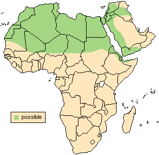
Why are you adhering so devotedly to those terms and division of Allah’s Earth that the colonists have invented. Can’t you see that they are politically motivated? Look at the landmass that you insist on calling “Africa” and look at Arabia. Why do you think the colonists named them two different continents:

Why did the colonists make the cut-off point the Red Sea and not the Arabian Gulf (The Persian Gulf)?
Look at the distance between Mozambique and Madagascar and bear in mind that Madagascar is considered a part of what they called “Africa”:

Now look at the distance between Arabia and Sudan and tell me why they are considered two different land masses and why Mozambique and Madagascar aren’t:

This is what it is in reality – ONE LANDMASS:
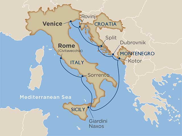
Now look at Georgia and Croatia and tell me why Italy and Croatia are considered the same land mass and Sudan and Arabia aren’t:
How do they go about dividing Allah’s Earth? Where is the cut-off point between what they call Europe and what they call Asia? There is no water that separates them, so why didn’t they make Syria and Iraq the cut-off point between what they called “Africa” and what they called “Asia”: